
Find San Francisco Street Parcels
The strongest San Francisco street directory method starts with one known San Francisco address and moves through five evidentiary layers. San Francisco Planning's Property Information Map, called PIM, establishes the mapped parcel and its block and lot. The San Francisco Assessor adds assessment and property facts. The San Francisco Recorder adds title parties and legal descriptions. San Francisco DBI adds permit and complaint chronology. Historical San Francisco directories and voter archives add listed people for the years they cover.
- Enter the San Francisco address in PIM, accept the normalized street form, and save the block and lot shown for the parcel.
- Open the San Francisco Assessor Property Search with the address or block and lot; preserve leading zeroes in the local identifier.
- Walk the San Francisco map along both sides of the street, clicking each parcel instead of assuming that one building address equals one lot.
- Use the San Francisco block and lot, current owner, and date to locate the Recorder document, then work backward through grantor and grantee roles.
- Overlay a historical San Francisco reverse directory, voter register, census entry, or newspaper notice when the question concerns a past listed household.
That sequence makes the San Francisco street directory an address-led research trail rather than a promise of a complete household list. A current street question may end with a parcel owner. A historical question may end with a printed name. Label the result accordingly.
San Francisco Street Search Fields
The San Francisco Property Information Map is a free interactive GIS viewer. San Francisco address autocomplete or a map click leads to parcel geometry, block and lot, planning districts, zoning, applications, permits, and historic-resource links. The San Francisco Assessor Property Search is the matching property tool. Its San Francisco public route is address and block-and-lot oriented, and an unrestricted owner-name search is not advertised.
| Field or control | Type and use |
|---|---|
| San Francisco address | Autocomplete or text; the best public start for a known San Francisco street number. |
| San Francisco block | Text field used with lot; preserve local leading zeroes. |
| San Francisco lot | Text field used with block; condominium lots can differ from the base parcel. |
| San Francisco map click | Selects a parcel or abutter directly when a San Francisco address search is unclear. |
| San Francisco layers and identify | Turns on parcels, zoning, districts, planning or historic context and inspects a map feature. |
A San Francisco PIM result can include address, block and lot, geometry, lot dimensions or area where supplied, planning references, building permits, and historic-resource survey links. The San Francisco Assessor adds assessed values and tax characteristics. Neither San Francisco tool is a title report or a complete resident roll.
Browse San Francisco Streets Parcel by Parcel
San Francisco street-by-street browsing works visually. Search a neutral San Francisco address in PIM, zoom until parcel outlines appear, click the target, and record its block and lot. Then click the immediately adjacent San Francisco polygons along the same side, across the street, and at the corners. Open each San Francisco property panel independently. A map pan or identify tool takes the place of a public all-neighbors button.
San Francisco corner geometry needs care. A corner parcel may carry a situs address on one street while its entrance faces another. A San Francisco building can contain many condominium lots. Public rights of way can interrupt what appears to be a continuous block. Do not infer a person's connection from San Francisco map proximity. Save the San Francisco parcel key and the source date for every address in the chain.
- San Francisco parcel
- A mapped unit of San Francisco land identified by the city's block-and-lot system.
- San Francisco situs address
- The physical San Francisco address assigned to the parcel, which may differ from a mailing address.
- San Francisco plat or map context
- The diagram and legal geometry that help bridge San Francisco lots, subdivisions, and older descriptions.
- San Francisco criss-cross directory
- An address-first historical volume that turns a San Francisco street or telephone clue into a listed person or business.
The definition matters because a San Francisco address is a search key, not a person. The San Francisco street directory becomes more reliable when each result says whether it came from a San Francisco map, assessment, deed, permit, or historical listing.
San Francisco Street Records by Address
Several San Francisco County sources can be searched by a San Francisco address or its parcel key, but they carry different kinds of evidence. This coverage table is the core of an address-based San Francisco street directory. It also shows where a search must change from a San Francisco web tool to a counter, library, or archive.
| Record set | Keeper | What it shows | Access |
|---|---|---|---|
| San Francisco assessment record | San Francisco Assessor-Recorder | Block and lot, situs, use, values, building and lot facts | Web tool, counter, lawful request |
| San Francisco Property Information Map | San Francisco Planning | Parcel geometry, zoning, districts, planning and permit links | Free interactive GIS |
| San Francisco recorded documents | San Francisco Recorder Division | Grantor, grantee, instrument, date, legal description | Index, copies, City Hall route |
| San Francisco permits and complaints | San Francisco DBI | Application, work, contractor or applicant, inspections and status | Free portal; plans may need records staff |
| San Francisco reverse directories | San Francisco SFPL | Address or telephone to a listed person or business | Library, print, microfilm, digitized runs |
| San Francisco historical voter registers | San Francisco SFPL and FamilySearch | Covered voters by address, age, party and sometimes occupation | Archival years and notice rules |
The San Francisco block and lot ties a current map to a deed and permit. A San Francisco street name ties a parcel to an address list. A year ties a printed listing to a San Francisco era. When a source lacks one of those bridges, mark the result as a lead rather than a resident fact.
Trace a San Francisco Street Deed Chain
San Francisco recorded documents are indexed by parties and legal descriptions, not as a simple “who lived here” search. The San Francisco address-to-deed method is indirect. Begin with the current block and lot, locate the vesting instrument, and read the legal description. Note the current grantee, the seller or grantor, document number or book and page, recording date, and instrument type. Then search the seller as an earlier grantee while checking date, spouse, trust, and entity variants.
- Normalize the address in PIM and save the exact block and lot.
- Use the Recorder copy route to locate the modern vesting document and read its legal description.
- Search both grantor and grantee roles for the earlier transaction, narrowing by date and instrument type.
- Repeat backward through 1914, preserving every deed book, page, document number, and party variant.
- Bridge 1848-1913 with SFPL's incomplete grantor and grantee index, then request the referenced deed book and page.
Ownership and occupancy remain separate. A deed establishes that a named party received or transferred an interest. It does not establish who lived at the address or where the former seller went. To add household context, use the library's reverse volumes, special street lists, census, Great Registers, newspapers, and obituaries.
The recorded-document copy service explains the document-oriented route and prerequisites.
Copy and certification costs should be checked against the Recorder fee schedule before an order is sent.
[RESEARCH GAP: no single official list of every historical San Francisco street renaming or renumbering year was located, and successful assessor, GIS, and Recorder deed-index screenshots were not available in the manifest.] Use SFPL street-name files, Board ordinances, contemporaneous maps, block books, cross streets, and legal descriptions when a modern address does not match an older entry.
San Francisco Reverse Directories Fill the Past
Regular Polk reverse sections begin in 1953, but older address-first material exists. SFPL lists Street Address Lists for 1933 and 1936, a House and Street Directory for 1940, and Andrews Real Property Directories for 1943 and 1949. Haines criss-cross volumes run from 1976 through 2021. The broader alphabetic San Francisco city directory run covers 1850-1982 with gaps.
A quoted address in Ancestry Library Edition's California voter database can search San Francisco registrations from 1900-1940. Great Registers held by the History Center cover 1866-1964 with an incomplete 1985 set, while access to 1945-1964 needs 48-hour notice. These are historical listed or registered people, not a current street roster.
When an address fails, search the person's surname, spouse, employer, initials, and nearby cross street. Early volumes use publisher abbreviations and may place women under a husband's identity. Absence can mean a move, death, omission, a publication gap, or a street change.
San Francisco Street Voters by Address
Historical voter registers add a dated address clue when a street directory has a gap. The Great Register collection at SFHC covers 1866-1964 with an incomplete 1985 set, and online portions cover 1867-1940. Entries may include name, address, age, party, and sometimes occupation. Ancestry Library Edition's California voter database can search a quoted address for San Francisco registrations from 1900-1940.
Modern voter access is different. The SF Elections Voter Portal authenticates one person with house number, ZIP Code, and date of birth. It does not provide an ordinary public by-street browse. Broader voter-file access is restricted to approved purposes under Elections Code sections 2188 and 2194 and related regulations. Confidential voters are excluded.
Use a historical register to corroborate a name and era, then compare the address with a deed, directory, census, or newspaper. Access to 1945-1964 registers needs 48-hour notice, so verify the library schedule before relying on that set.
San Francisco Street Permit Chronology
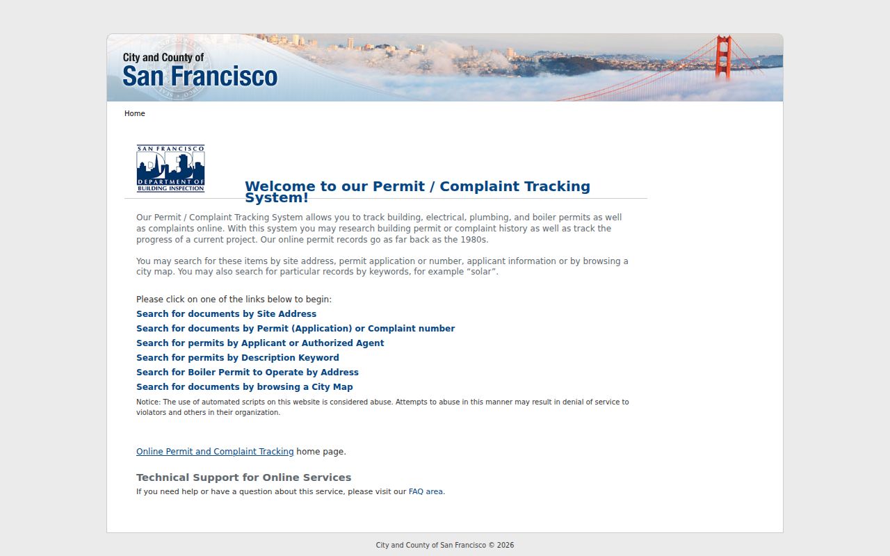
The San Francisco DBI Permit Tracking portal offers address, block-and-lot, permit or application, and start or end date modes. Results can show application or permit number, address, block and lot, work description, filing, issuance and completion status, estimated cost, contractor, inspections, and complaints. A permit applicant or agent is evidence of an action tied to a building, not proof of residence.
The San Francisco DBI capture shows how a street directory search can add dates and work history after PIM identifies the parcel.
Plans and some records may require DBI Records Management access. Privacy, copyright, and security redactions can apply. Use DBI to date construction, alterations, inspections, and complaints, then check a deed or directory for any person-related conclusion.
Bridge San Francisco Streets and Numbers
San Francisco street numbers generally progress along named streets, but hills, old surveys, subdivisions, numbered avenues, alleys, and post-1906 rebuilding interrupt a simple national grid assumption. A modern text search can miss an older entry after a street name change, subdivision, or new parcel split. The safe bridge is block and lot, a contemporaneous map or block book, cross streets, the legal description, and a matching directory year.
Block books provide ownership and lot snapshots, including 1894, 1901, January and October 1906, 1907, 1909 or 1910, 1925, and partial earlier and later sets. Sanborn maps add footprint, use, materials, and street-number context, although exact sheet years vary by district. Original SFPUC water applications, requested from the Water Department, can provide a building or service-date clue before a permit summary.
Do not silently interpolate missing directory years. SFPL's online list identifies gaps including 1851, 1855, 1857, 1866, 1870, 1947, and 1950. Record the gap, then use a nearby year or a different source.
San Francisco Street Directory Limits
No public source supplies a complete street household. Assessment records emphasize ownership. Utility and DMV customer addresses are protected. The voter portal authenticates one person and broader voter-file access has purpose restrictions. Historical directories were selective, publishers missed people, and protected residents can be deliberately hidden.
Lawful use. San Francisco address records support personal research, family history, reconnecting, and civic curiosity. Do not use a street directory result to stalk, harass, threaten, impersonate, or intimidate anyone.
When the goal changes from a whole street to one person, use the San Francisco resident lookup path. When the question is who sits immediately beside one parcel, the San Francisco neighbors path keeps adjacency and community contacts distinct from a full street chain.