
San Francisco ZIP Codes and Their Areas
The official San Francisco city appendix maps 27 commonly used geographic codes. The San Francisco area names below are useful orientation, not legal neighborhood polygons. San Francisco post-office notes are broad service descriptions, so an exact San Francisco address still needs USPS verification before it is used to filter a San Francisco postal search.
| ZIP | Areas in the official city table | Post-office context | Records note |
|---|---|---|---|
| 94102 | San Francisco Hayes Valley, Tenderloin, North of Market, Civic Center | San Francisco Civic Center area stations | Crosses neighborhood lines |
| 94103 | San Francisco South of Market | San Francisco SOMA delivery area | Mixed parcel and use types |
| 94104 | San Francisco Financial District | San Francisco business-dominant unique-address context | Entity records can be useful |
| 94105 | San Francisco Financial District South, Embarcadero, Rincon Hill | San Francisco Rincon and South Beach area | High-rise condominium lots |
| 94107 | San Francisco Potrero Hill, Dogpatch | San Francisco Potrero and Dogpatch | Mission Bay edge varies by source |
| 94108 | San Francisco Chinatown, Union Square | San Francisco Chinatown and Union Square | Mixed residential and business listings |
| 94109 | San Francisco Tenderloin, Nob Hill, Russian Hill | San Francisco central and north-central stations | Several neighborhoods share the code |
| 94110 | San Francisco Inner Mission, Bernal Heights | San Francisco Mission and Bernal | Not coextensive with Mission District |
| 94111 | San Francisco Financial District, Embarcadero | San Francisco Embarcadero | Business-heavy waterfront |
| 94112 | San Francisco OMI, Excelsior, Outer Mission | San Francisco Ingleside and Excelsior | Older source calls it most populated |
| 94114 | San Francisco Castro, Noe Valley | San Francisco Castro and Noe | Edges cut neighborhood labels |
| 94115 | San Francisco Western Addition, Japantown, Fillmore, Pacific Heights | San Francisco Fillmore and Western Addition | District boundaries differ by source |
| 94116 | San Francisco Parkside, Sunset, Forest Hill | San Francisco west-side station | Shares Sunset with 94122 |
| 94117 | San Francisco Haight and Ashbury | San Francisco Haight, Cole, and NoPa context | Labels vary by source |
| 94118 | San Francisco Inner Richmond | San Francisco Richmond and Laurel Heights edges | Not an exact neighborhood polygon |
| 94121 | San Francisco Outer Richmond | San Francisco Outer Richmond | Coastal and Lincoln Park context |
| 94122 | San Francisco Inner and Outer Sunset | San Francisco Sunset stations | Broad east-west slice |
| 94123 | San Francisco Marina | San Francisco Marina and Cow Hollow | Official table simplifies the edge |
| 94124 | San Francisco Bayview-Hunters Point | San Francisco Bayview | Industrial and residential mix |
| 94127 | San Francisco West Portal, St. Francis Wood, Miraloma | San Francisco west of Twin Peaks | Several small neighborhoods |
| 94129 | San Francisco Presidio | San Francisco Presidio federal enclave | Federal land context |
| 94130 | San Francisco Treasure Island | San Francisco Treasure Island | Island and redevelopment context |
| 94131 | San Francisco Glen Park, Twin Peaks, Diamond Heights | San Francisco central-south hills | Topography splits street segments |
| 94132 | San Francisco Ingleside, Merced, Parkmerced | San Francisco Lakeshore and Stonestown | Campus and large-parcel context |
| 94133 | San Francisco Chinatown, North Beach, Pier 39 | San Francisco North Beach | Tourism, business, and residential mix |
| 94134 | San Francisco Visitacion Valley, Sunnydale | San Francisco southeast | City-line proximity needs parcel check |
| 94158 | San Francisco Mission Bay | San Francisco Mission Bay | Newer code reflects redevelopment |
The official San Francisco appendix supplies the mapped ZIP and neighborhood table used here.
Why San Francisco Has More ZIP Codes
The mapped geographic ZIPs do not exhaust San Francisco's postal universe. A San Francisco ZIP code directory view can include postal codes beyond the geographic table. A San Francisco health-atlas analysis counted 56 postal codes touching or assigned within the city at that time: 29 residential, 12 PO-box-specific, and 15 unique-business codes. San Francisco postal assignments change, and San Francisco PO-box or unique codes should not be presented as residential areas without an address or company match.
San Francisco ZIP geography also differs from government geography. San Francisco's consolidated city-county boundary is stable compared with many growing western cities, but the San Francisco Presidio introduces federal land and Treasure Island introduces island and redevelopment records. Daly City addresses just south can look continuous with San Francisco while belonging to San Mateo County. A San Francisco postal city label alone is not a county or parcel answer.
[RESEARCH GAP: USPS does not publish a stable public page enumerating every current San Francisco PO-box and unique-business code with station names.] Verify each address, company, or PO box in the live USPS tool.
Three ZIP Boundary Traps in San Francisco
San Francisco 94110 covers both the Inner Mission and Bernal Heights, so a ZIP-only result should not be labeled simply “Mission.” San Francisco Chinatown appears in both 94108 and 94133, and San Francisco Sunset is divided between 94116 and 94122. These are not errors. They show why a San Francisco ZIP map needs a second geography when the question is about a street or neighborhood.
San Francisco Mission Bay's 94158 reflects newer development and parcel growth. San Francisco Presidio 94129 crosses a federal enclave context. San Francisco Treasure Island 94130 is an island geography with its own redevelopment history. A ZIP narrows delivery space, while San Francisco PIM, a district map, or a legal parcel source explains the local record keeper.
Use the San Francisco ZIP as a filter label, not as a substitute for the San Francisco address, block and lot, county, or custodian.
Verify a San Francisco ZIP With USPS
The USPS lookup offers three distinct modes: ZIP Code by Address, ZIP Codes by City and State, and Cities by ZIP Code. San Francisco address mode accepts street address, city, state, and an optional company. An exact San Francisco deliverable address can return a standardized address and ZIP+4. City mode returns a delivery list, not a map of San Francisco city limits.
| USPS mode or result | Use |
|---|---|
| ZIP Code by Address | Enter street address, city, state, and company when needed to verify one deliverable address. |
| ZIP Codes by City and State | List codes associated with a postal city; do not treat it as a resident list. |
| Cities by ZIP Code | Enter a code to see associated postal-city names. |
| Find and Clear | Submit the query or reset the fields for another address or code. |
| ZIP+4 result | Refines delivery for the exact address; it does not create a neighborhood boundary. |
The USPS capture shows the address and city search choices.
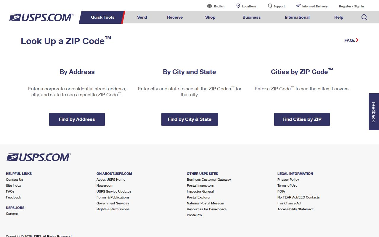
USPS verification is the right final San Francisco check before a ZIP is attached to a San Francisco address record or dataset.
Find San Francisco Residents by ZIP
A San Francisco ZIP-filtered search should narrow the geography before it asks a different San Francisco record system about a person, parcel, or organization. The San Francisco ZIP workflow below avoids turning a postal code into a false household claim.
- Verify the exact San Francisco street address or city and state through USPS, and save the ZIP and ZIP+4 when returned.
- Check the official San Francisco city ZIP table for the broad neighborhood context, while noting that labels overlap.
- Move to San Francisco PIM or the Assessor when the question concerns a parcel, block, lot, planning case, or permit.
- Use San Francisco court, business, license, directory, or historical voter sources only for the record type they actually keep.
- Record the San Francisco dataset date, geocoding limits, and any city or county mismatch before comparing results.
The San Francisco voter portal is not a ZIP-wide search. It requires the registered voter's ZIP as an authentication field. San Francisco PIM and Assessor are address and block-and-lot tools. DataSF datasets may expose a ZIP column for San Francisco permits, parcels, or businesses, but an export is evidence about those records, not a list of residents. That San Francisco ZIP code directory workflow keeps the postal filter tied to its source.
San Francisco ZIP Filters Have Limits
Local portals can use ZIP in narrow ways. The voter portal uses it to authenticate one voter. A DataSF dataset may use it as a field on a permit, parcel, business, or civic record. The Assessor and PIM focus on address and block and lot. A ZIP filter should name the source field and the record date rather than implying that every person in the code appears.
| Tool | ZIP role | What the result is about |
|---|---|---|
| USPS Lookup | Address, city, or code verification | Delivery geography and standardized mail address |
| SF Elections Portal | Authentication field | One voter's registration service |
| PIM and Assessor | Secondary address context | Parcel, assessment, planning, and permit records |
| DataSF | Dataset column when supplied | Permits, complaints, parcels, businesses, or civic data |
A ZIP filter can narrow a lawful search while still leaving the identity question open. Once a ZIP narrows to a street, use the San Francisco street directory by address route for parcel-level work.
[RESEARCH GAP: no successful ZIP-capable local-portal screenshot was available in the manifest.] PIM, the Assessor, and DataSF remain the documented local routes, with their field and dataset limits.
San Francisco Postal Codes and City Limits
ZIP boundaries do not define San Francisco neighborhoods, supervisor districts, census tracts, or the legal city-county line. A parcel's situs, an owner's mailing address, and a deed's legal description can all differ. The city's consolidated government means city and county often name the same custodian, but a nearby postal city can cross that jurisdictional line.
Use county and parcel verification when an address sits near Daly City, the Presidio, Treasure Island, or a redevelopment edge. A familiar neighborhood label can be too broad. A ZIP map is a first cut, not a final jurisdiction decision.
San Francisco Population and ZIP Context
Census QuickFacts reports 826,079 San Francisco residents in the July 1, 2025 estimate, a 2020 decennial count of 873,965, 46.91 square miles, and 18,629.1 people per square mile in 2020. It also reports 363,970 households and 2.21 persons per household for 2020-2024, with 38.2% of occupied units owner-occupied.
Those numbers explain why a postal code or property roll cannot stand in for a household list. Many residents do not appear in an owner record, and a dense ZIP can contain several kinds of parcel and civic records.
The Census geography capture supplies the population context for a ZIP-level search.
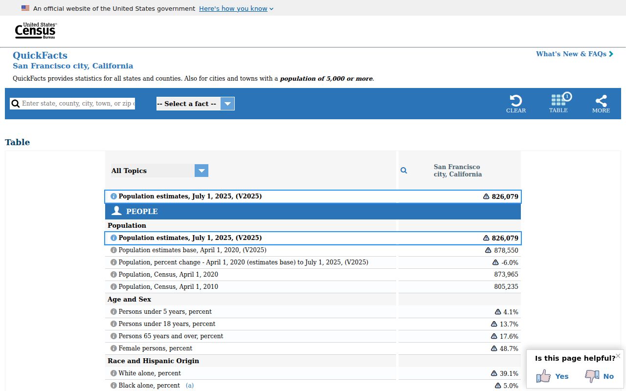
Population context helps set expectations for a narrow ZIP search, but it does not identify any individual.
California Privacy Rules for San Francisco ZIPs
California's CCPA and CPRA give covered-business consumers rights to know, delete, correct, limit sensitive-information use, and opt out of sale or sharing, subject to exceptions. The Attorney General's CCPA guidance concerns covered businesses and consumer data, not deletion of a Recorder deed, court index, or government parcel record.
A ZIP filter should never become a workaround for protected data. DMV information, utility customer data, confidential voters, Safe at Home participants, sealed court material, and adoption records remain controlled by their own laws and custodians. Public records support personal research and civic understanding, not stalking or harassment.
The California privacy guidance capture shows the consumer-rights source.
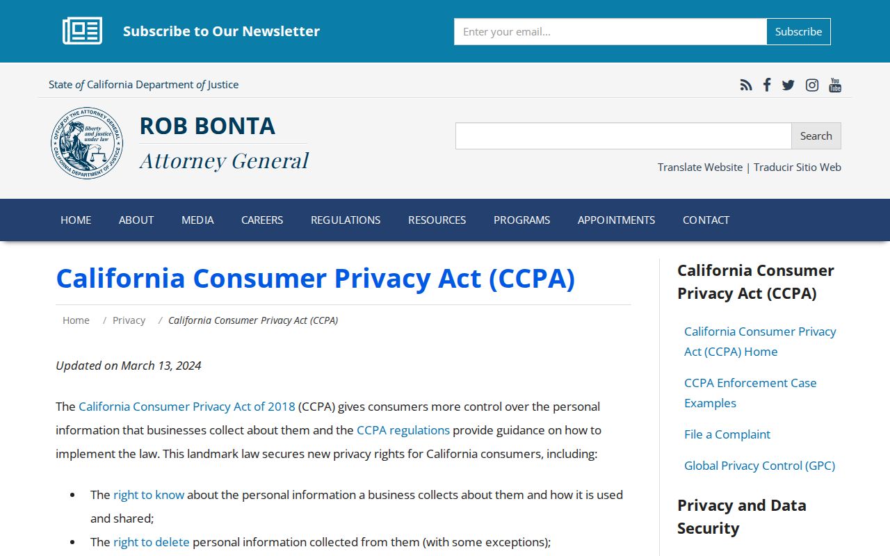
Privacy rights and public-record access operate on different tracks, so use the custodian named for the underlying record.
San Francisco ZIP Code Directory Limits
A San Francisco ZIP code directory can be shared by a business district, a neighborhood edge, a federal enclave, and a mixed-use parcel. A city ZIP table can be older than a postal assignment. A dataset can have missing or failed geocodes. The best ZIP result states the source date, the geographic meaning, and the record type behind every count or name.
Lawful personal use. Use ZIP information for genealogy, reconnecting, civic research, and understanding a delivery area. Do not use a ZIP result to stalk, harass, threaten, or harm anyone.
For a historical address, move to the previous residents trail. For a block around a verified parcel, use the neighbors route. Both preserve the difference between postal geography and a person.